Google Maps to Expand Driving and Walking Directions in South Korea; Security Compliance Confirmed (Updated)
TMAP to Supply Processed High-Precision Map Data
Restrictions on Imagery and Street View Around Military Facilities
Groundwork Laid for Expanding Services in South Korea
Google is expected to expand services on Google Maps in South Korea, including driving and walking directions, after fulfilling the security requirements for exporting high-precision map data from the country. Google will receive map data processed by TMAP and security-processed imagery and incorporate them into its services.

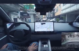
At a meeting on November 13, the Ministry of Land, Infrastructure and Transport confirmed that Google had met the security requirements attached to its permit to export map data at a scale of 1:5,000, laying the groundwork for Google to expand its directions services in South Korea. The data approved for export consists of traffic network information, including the base map, road networks, road names, the number of lanes, speed limits and road geometry. Using high-precision map data containing detailed traffic information, Google will be able to expand its services to include driving and walking directions.
TMAP will process and supply the map data to Google. The two companies signed a related contract on August 31, 2026. TMAP will process the map data on servers in South Korea, and Google will incorporate it without altering the terrain features.
Locations and areas of military and security facilities are classified as sensitive information and will therefore be subject to security processing. To this end, TMAP will supply security-processed imagery, which Google will incorporate without modification. Google has temporarily obscured facilities it identified using foreign commercial satellite imagery, but the security measures will be applied when that imagery is replaced with security-processed imagery from South Korea.
Street View, which shows street-level scenes, will also be restricted around security facilities. Google has deleted Street View images of the interiors of military and security facilities it identified and security-processed, as well as images of roads within 50 meters of their boundaries. Once domestic imagery is provided, Google plans to delete Street View images of the interiors of all military and security facilities and the areas around them.
A system for responding to security incidents involving domestic map services will also be established. Google will designate the president of Google Korea as its officer responsible for domestic maps and set up a real-time response system to handle government requests. In the event of a national security emergency, such as a large-scale natural disaster or armed conflict, Google will consult with the government to modify areas subject to security processing or disable specific features.
The government will continue to monitor the export of domestically security-processed imagery and processed data, as well as compliance with the security requirements. It plans to suspend the permit if a serious breach of the requirements occurs.
Hot Picks Today
 "Two Spend 500,000 Won in a Flash, Yet Wait Two Hours?" ... 'Dreamland' Shunned by Kids and Foreign Tourists
- The Era of Getting 200 Million Won After 30 Years Is Over... A Japanese Bank's "Perpetual Department Head" Who Just Clocked In Cries Out
- Spain Hit by Its Worst Tragedy... Lee Kangin, Moreno and Real Madrid Join Soccer World in Mourning
- They Said, “Make It Your Home for Life” - Then Suddenly Kicked 200 Passengers Off... What Happened to the Around-the-World Cruise?
- "130 Rice Bowls Sold Out in a Day"... 'Unfiltered Face' Adds 8 Million Won to Night Market Sales: China's Bungeunwoo
Google said it plans to run a multi-year cooperation program with domestic geospatial information companies to support mutually beneficial growth. The government plans to support cooperation between Google and domestic industry by developing specific measures, including technology cooperation and investment, and helping ensure they are implemented on an ongoing basis.
© The Asia Business Daily. All rights reserved. Unauthorized AI training and use prohibited.