[Walking Through Seoul] Line 7 Crosses the Han River, Line 9 Runs Along It
Labor and Production: The Dynamic Line 7
Uijeongbu to Bucheon: Seoul's Warp Thread
Middle-Class Hubs in Jungnang and Gwangjin
A "Renewed City," Not a New Town
Capital and Speed: The New Line 9
Magok to Dunchon: Seoul's Weft Thread
Workplaces for Knowledge-Industry Professionals
Gated Luxury Apartment Complexes
Inside the Four Great Gates: Restoration and Preservation
Beyond Them, "Today's Seoul" Expands

The ways in which the two subway lines relate to the Han River vividly reveal the distinct paths of development taken by modern Seoul. Line 7 crosses the Han River from north to south. On this line, which crosses in a flash from Ttukseom Hangang Park in the north of the river to Cheongdam in Gangnam via Cheongdam Bridge, the Han River is a physical boundary that must be crossed. Line 7 begins in Jangam, Uijeongbu, passes through high-density bedroom communities such as Nowon and Jungnang, cuts through Gangnam, and then continues past Daerim-dong and Gasan Digital Complex in the southwest to Gwangmyeong, Bucheon, and Incheon. Its route symbolizes a "Seoul of production and everyday life" that sustained industrialization and population growth. For Line 7 passengers, the Han River is less a spectacular view than a turning point in daily life, encountered on their commutes between homes north of the river and workplaces in Gangnam and the southwest.
Line 9, by contrast, never crosses the Han River. Instead, it runs alongside the river on the Gangnam side before cutting through the heart of Gangnam and heading toward Songpa. On Line 9, the Han River is not an obstacle to overcome but an axis of prestige that generates enormous economic value in its own right. Starting in Magok on Seoul's western edge, an area planned as an advanced research and development hub, the line passes through Yeouido's financial district and Banpo's ultra-high-priced redevelopment complexes before threading through Gangnam's business district. It offers a vivid picture of a "Seoul of capital and globalization" reshaped since the 2000s. Its connection to Gimpo International Airport, its status as a privately financed project involving foreign capital when it was built, and its distinction as the first Seoul subway line to introduce express trains are all symbolic. Demand for speed and efficiency was so strong that the express trains became known as "hell trains" during rush hour.

Consider the contrast between the places where people work. Gasan Digital Complex, the southwestern anchor of Line 7, is a dense concentration of knowledge-industry centers built on the site of Guro Industrial Complex, once a cradle of the textile, garment, and electronics industries in the 1960s. Because it was developed on former industrial land, it is less like a vast new town than a place where existing urban space has been renewed to meet the needs of a new era. Next door, Daerim-dong has become a commercial district for ethnic Koreans who migrated from China. Just as the Guro Industrial Complex workforce was made up largely of young women who had come from other parts of the country, ethnic Korean migrants from China came to Seoul to work with hopes for the future. Seen this way, Seoul was a "city of hope" where not only young people from other parts of Korea, but also overseas Koreans and foreign workers, came to seek opportunity.
Magok, the western anchor of Line 9, is a planned city developed in the 21st century on one of the last large expanses of farmland remaining in Seoul. Major corporate research centers such as LG Sciencepark and Seoul Botanic Park are among its landmarks. With ample greenery among new buildings and well-planned roads and pedestrian paths, the area seeks to move beyond Seoul's image as a complicated and disorderly city. It conveys a sensibility reminiscent of technology hubs around the world, while also giving an impression of sterility. Though they had different beginnings, Gasan and Magok have both become important hubs for Seoul's knowledge industries and workplaces for white-collar professionals.
The contrast between housing and everyday life is also stark. In areas along Line 7, including Jungnang-gu, Gwangjin-gu, and Dongjak-gu, there are many alleys lined with multi-family homes and traditional markets, and a large share of residents are middle-class. The apartment complexes in Sanggye-dong and Junggye-dong in Nowon were built from the late 1980s to the early 1990s. Now considered older housing, they are at the center of active discussions about redevelopment. In areas dense with villas, aging housing has slowed the influx of young people, and the population is aging rapidly.

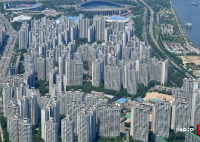
By contrast, gated luxury apartment complexes line Line 9. From Heukseok and Banpo to the massive redevelopment complexes in Dunchon-dong, those built in the 21st century are the glamorous face of "luxury Seoul." The apartments in Yeouido, built in the 1970s, are also awaiting redevelopment. As housing prices in Seoul continue to rise, these neighborhoods are objects of aspiration but also fuel relative deprivation and social alienation, taking root like foreign implants in the body of Seoul.
Finally, because both lines run around the historic city center, they pass relatively few famous cultural heritage sites. The best-known cultural heritage sites in the Line 7 area are Taereung and Gangneung, which are part of the UNESCO World Heritage-listed Royal Tombs of the Joseon Dynasty. Instead, the area has everyday green spaces, including Dobongsan and Suraksan, which are crowded with hikers on weekends; Children's Grand Park and Boramae Park; and Gyeongchun Line Forest Trail, where an old railway line was converted into a park. Universities are another notable feature. Seoul National University of Science and Technology, Sejong University, Konkuk University, and Soongsil University all appear in the names of Line 7 stations. Most likely, they settled on large plots of land on what were then the outskirts of Seoul in the 1940s to 1960s, before the city expanded rapidly.
There are somewhat more landmarks around Line 9. They include sites from the Hanseong Baekje period, such as Mongchontoseong Fortress and the Seokchon-dong Ancient Tombs; Seolleung and Jeongneung royal tombs, and Bongeunsa Temple, which once protected Seolleung; the Seoul National Cemetery and the National Assembly Building; Seonyudo Park and Seoul Botanic Park; and Jamsil Sports Complex and Olympic Park. From the capital of Hanseong Baekje more than 1,600 years ago to traces of the 1988 Seoul Olympics, the historical span is surprisingly broad. By contrast, there are relatively few universities: Chung-Ang University in Heukseok-dong and Korea National Sport University in Songpa. Since the 1970s, the government has strictly restricted the establishment of new universities in Seoul to curb population growth in the capital region, and the Capital Region Readjustment Planning Act of 1982 formalized the policy.

If the area within the Four Great Gates is a historic city center shaped by restoration and preservation, the areas served by Lines 7 and 9 are "today's Seoul," where people actually work and live. The hardships of industrialization and labor, the rise and aging of the middle class, the development of apartment living and its less visible side, and the efficiency and sterility of planned urban spaces all coexist in varied ways along the two lines.
The two lines also show the pace of change in Seoul. The first section of Line 7 opened in 1996, and Line 9 began operating in 2009. Both came after the rapid-growth period that began in the 1960s and lasted for more than 30 years had started to lose steam in the mid-1990s. Yet Seoul has continued to change amid the digital revolution, shifts in its population, and relentless development and redevelopment. Even now, Line 7 is extending toward Cheongna in Incheon, while Line 9 is extending toward Godeok in Gangdong. As the lines on the subway map grow longer, "the real Seoul" is moving ever farther from the area within the Four Great Gates.
Hot Picks Today
 "Samsung Electronics Employees Commute by Shuttle Bus"... More Than 5,000 Homes to Be Supplied in Seoul and Busan [Real Estate A to Z]
- A 12-Year-Old Girl Went to the Hospital After Her Blood Pressure Hit 225 and Was Stunned: "What Is This Coral Reef-Like Thing in Her Aorta?"
- Even a National Treasure and Top Taxpayer Say, "I'm Leaving This Country"... UK Loses £120 Billion as Tax Hikes on the Rich Backfire
- "Hey, Lady, Teach Your Kids to Behave!" ... 300,000 Won in Cash and a Bodily Injury Claim Demanded Over Child's Door Ding
- "If This Airs, I'm Dead"... Why a Restaurant Refused to Let Jeon Hyunmoo's Show Film
Robert Fouser, writer and former Seoul National University professor
© The Asia Business Daily. All rights reserved. Unauthorized AI training and use prohibited.