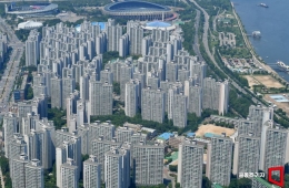
From Crop Growth to Wildfire Damage... Observing the Korean Peninsula from Space
Revisiting the same site within two days using Land Observation Satellites No. 1 and 2
120 km-wide coverage with the Agricultural and Forestry Satellite
Full-scale management of crops and forests begins
Satellite data to be used more for analyzing wildfire damage and restoration than for direct firefighting
The Land Observation Satellite No. 2 and the Agricultural and Forestry Satellite, both launched this year, have successfully acquired images from orbit, preparing for full-scale utilization. The Land Observation Satellite has obtained high-resolution images capable of distinguishing types of vehicles on the ground, while the Agricultural and Forestry Satellite has captured wide-area images that cover most of the Korean peninsula within three days.
On October 1, the Korea Aerospace Administration, the Ministry of Land, Infrastructure and Transport, the Rural Development Administration, and the Korea Forest Service held a press briefing and released the initial operational achievements of the next-generation medium-sized satellites No. 2 (Land Observation Satellite No. 2) and No. 4 (Agricultural and Forestry Satellite).

Next-generation Medium-sized Satellite No. 4 (Nonglim Satellite) captured the wildfire damage area in Miryang, Gyeongnam, on August 6. Comparing the standard RGB image (left) with the NIR-Red-Green image using near-infrared (right), the areas with vegetation changes due to the wildfire can be more clearly identified. The yellow line indicates the boundary of the wildfire damage. The spatial resolution is 5 meters. Provided by the National Institute of Forest Science.
View original imageThe Land Observation Satellite No. 2, launched on May 3, observes the ground with a spatial resolution of 0.5 meters in black and white and 2 meters in color. It is capable of distinguishing the types of parked vehicles on the ground. During its initial operations, it captured images of various locations such as Dokdo, Seoul Olympic Stadium, Niagara Falls in the United States, and Star Lake City in Hanoi, Vietnam, to verify its observation capabilities.
Operating Land Observation Satellites No. 1 (launched in 2021) and No. 2 together reduces the revisit time for the same area to less than two days—half the time compared to using a single satellite. The two satellites can also perform "stereo imaging," capturing the same area from different angles to produce three-dimensional spatial information.
Hyojin Yang, a facility researcher at the Land Satellite Center of the National Geographic Information Institute, explained, "Operating Land Observation Satellites No. 1 and No. 2 simultaneously reduces the revisit interval for the same point by half, enabling new images within about two days. We can also secure stereo satellite images to build three-dimensional spatial information of the ground."
So far, about 1.6 million images from Land Observation Satellite No. 1 have been downloaded free of charge. The Land Satellite Center corrects for location errors in satellite images to achieve a ground positional accuracy of within one meter and provides additional information such as land use, buildings, roads, and time-series change detection data.
Agricultural and Forestry Satellite can observe the Korean peninsula in 3 days... but faces limits during the monsoon season
The Agricultural and Forestry Satellite, launched on July 7, is focused on frequent coverage of wide areas rather than high precision. Its spatial resolution is 5 meters, but it can capture a swath 120 kilometers wide at a time. By passing over the Korean peninsula three times, it can observe about 95% of the area, and is capable of photographing the entire nation more than 100 times annually.

Hong Seokyoung, Director of the Agricultural Satellite Center at the Rural Development Administration, is explaining on the 1st the methods for observing and analyzing farmland and crops using the Next-Generation Medium-Sized Satellite No.4 (Agricultural Satellite). Provided by Korea Aerospace Administration (KASA).
View original imageHowever, a "3-day revisit cycle" does not necessarily mean that an image suitable for use will be obtained every three days. Due to the nature of optical satellites, it is difficult to observe the ground properly if there is cloud cover.
Seokyoung Hong, Director of the Agricultural Satellite Center at the Rural Development Administration, stated, "We need to determine how many usable images we can actually obtain after normal operations begin. Our goal is to secure images suitable for use about three times a month, but during the rainy months of July and August, we may be grateful to obtain even one image."
The Rural Development Administration plans to analyze key information such as the cultivation and harvest area, and the growth status of major crops, using images from the Agricultural and Forestry Satellite. By integrating satellite images with weather and on-site data, as well as artificial intelligence (AI), the agency aims to gradually produce 51 types of agricultural data—including farmland changes, crop-specific cultivation areas, growth, and agricultural disasters—by 2030. Once regular operation begins next year, basic products such as satellite images and vegetation indices will be released first.
Images from the Agricultural and Forestry Satellite will be provided to users within one day after acquisition, following correction and analysis. If daily image utilization is limited due to clouds, a method of compositing images from multiple time points will be used to reduce the impact of cloud cover.
In the forestry sector, the satellite is used to monitor disasters such as wildfires, landslides, and pest outbreaks over wide areas. During initial operations, the satellite captured images of areas in Hamyang and Miryang, Gyeongnam, affected by wildfires in February, and analyzed damage boundaries and vegetation recovery status.
However, the Agricultural and Forestry Satellite cannot detect wildfires in real time or be used directly for firefighting. Depending on the timing of the wildfire, it can take about nine hours to acquire and analyze images for morning events and up to 25 hours for those occurring in the afternoon, as the next acquisition must wait until the following day.

Park Chanyeol, Director of the National Forestry Satellite Information Utilization Center at the National Institute of Forest Science, is explaining the application methods in the forestry sector, including wildfire damage analysis using the 4th Next-Generation Medium-Sized Satellite (Agricultural and Forestry Satellite) on the 1st. Provided by Korea Aerospace Administration (KASA)
View original imageChanyeol Park, Director of the National Forestry Satellite Information Utilization Center at the National Institute of Forest Science, explained, "This satellite is not used for rapidly detecting and suppressing wildfires. Instead, it is valuable for mapping the boundaries of wildfire-damaged areas, assessing the intensity of damage, planning restoration, and monitoring how forest recovery progresses over time."
Both satellites have completed on-orbit system testing and are currently undergoing image verification and correction. After completing initial operations and verification by the end of this year, operations will be transferred to the National Satellite Operations Center, with full-scale missions beginning next year.
Korea Aerospace Industries (KAI), responsible for satellite development, also emphasized that the next-generation medium-sized satellite program has secured private-led integrated satellite system capabilities. The localization rate for the main satellite body’s components exceeds 75%, and for payloads, over 90%. KAI has also invested about 100 billion won of its own funds to establish a space center capable of handling all processes from design to manufacturing, assembly, and testing in a single facility.
Hot Picks Today
 "Two Spend 500,000 Won in a Flash, Yet Wait Two Hours?" ... 'Dreamland' Shunned by Kids and Foreign Tourists
- The Era of Getting 200 Million Won After 30 Years Is Over... A Japanese Bank's "Perpetual Department Head" Who Just Clocked In Cries Out
- Spain Hit by Its Worst Tragedy... Lee Kangin, Moreno and Real Madrid Join Soccer World in Mourning
- They Said, “Make It Your Home for Life” - Then Suddenly Kicked 200 Passengers Off... What Happened to the Around-the-World Cruise?
- "130 Rice Bowls Sold Out in a Day"... 'Unfiltered Face' Adds 8 Million Won to Night Market Sales: China's Bungeunwoo
Jongjin Jang, Head of Satellite Development at KAI, said, "This marks a foundation for shifting from government-funded research institutes to industry-led innovation in the space sector. Through technology transfer, we have gained independent satellite development capabilities, and have also secured a standard platform that can accommodate payloads for multiple missions."
© The Asia Business Daily. All rights reserved. Unauthorized AI training and use prohibited.