67,000 National Satellite Images with 0.55m Resolution Released Free for AI Training
KASA to Release High-Resolution Images from Multipurpose Practical Satellite 3 and 3A to the Private Sector
Over 300,000 Images by 2030 and 600,000 by 2035... Commercialization of AI Services Permitted
The government will make approximately 67,000 high-resolution satellite images captured by the Multipurpose Practical Satellites available free of charge to domestic companies. These companies may use the data for artificial intelligence (AI) training, enabling them to develop and commercialize satellite image analysis models and services.
The Korea Aerospace Administration (KASA) announced on September 29 that, starting September 30, it will release about 67,000 standard high-resolution images captured by national satellites for free, supporting the development of AI technology in the domestic satellite application sector.

Multipurpose Practical Satellite 3A (K3A, 0.55-meter class) captured the German Olympic Stadium. Provided by Korea Aerospace Administration (KASA).
View original imageThe standard images refer to satellite photos that have undergone geometric and radiometric corrections through standard processing, allowing them to be used without additional modification. Large-scale image datasets are necessary for the training, analysis, and validation of AI models using satellite imagery, but domestic companies have previously had difficulty securing enough high-resolution data.
The images released this time are optical satellite images of overseas regions, taken last year by Multipurpose Practical Satellite 3 and Multipurpose Practical Satellite 3A. Multipurpose Practical Satellite 3 delivers a resolution of 0.7 meters, while the 3A offers a 0.55 meter class; for this release, approximately 67,000 images with less than 25% cloud coverage were selected.
Over 600,000 Images to Be Released by 2035
Domestic companies can use the released images to develop satellite application technologies and services, including AI models. Commercialization of AI models and services trained with these images is also permitted. However, selling or redistributing the released satellite images themselves is prohibited.
KASA prepared this release plan after seven companies requested free access to national satellite standard images for AI model development in a survey conducted in February among satellite solution providers, holding business meetings and coordinating with related organizations as part of the process.
Companies wishing to use the images must submit the 'National Satellite Standard Image Request Form' to KASA. After review, the National Satellite Operation Center will sequentially provide the images to applicants.
The scope of the release will also expand. KASA plans to add more than 60,000 national satellite standard images each year, with a cumulative total planned to reach 300,000 images by 2030 and over 600,000 images by 2035.
Hot Picks Today
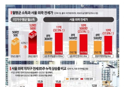 While Monthly Income Rises by 230,000 Won, Jeonse Jumps by 200 Million Won... Jeonse Surpasses Moon Administration after Sales
- [The World of Kickbacks]②Hanaro Mart Vendor Who Refused "Secret Money" Forced to Close After 10 Years
- "Pandas Instead of Rare Earths?"... Spotlight on 'Panda Diplomacy' as Pandas Return to Atlanta
- "One in Three Unsuitable for Marriage": 72-Year-Old Professor's Diagnosis Sparks Fierce Debate Among Chinese Netizens
Tae seog Oh, Administrator of KASA, stated, "We will boldly open up the national satellite standard images accumulated by the government to the private sector to actively support AI-based innovation by Korean companies," adding, "We will continue to expand both the scope and methods of release to foster a satellite information-based industry ecosystem led by the private sector."
© The Asia Business Daily. All rights reserved. Unauthorized AI training and use prohibited.

!["Failed Even With Net Assets of 400 Million Won?"... Six Criteria That Define 'The Real Middle Class' [Data Pick]](https://cwcontent.asiae.co.kr/asiaresize/307/2026092809144741876_1790554486.jpg)