Cheoin District of Yongin Adjusts Land Boundaries for 490 Parcels in Unhak 1 and 2 Districts
Portions of Village Roads Previously in Private Ownership
Now Incorporated into National and Public Land Boundaries
Acceleration of Long-awaited Resident Projects
Such as Road Paving and Infrastructure Improvements
The land boundaries of Unhak 1 and 2 districts in Cheoin District, Yongin, Gyeonggi Province have been readjusted to reflect their actual usage. As a result, a significant portion of the village roads, which was previously included in private property, has now been incorporated into national and public land boundaries. This change is expected to accelerate long-standing resident projects, such as road paving.

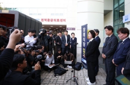
Yongin Special City Cheoin District has completed the cadastral resurvey project for Unhak 1 and 2 districts. Provided by Yongin City
View original imageCheoin District of Yongin Special City (Mayor Lee Sang-Il) announced on September 6, 2026 that it has completed the 2025 cadastral resurvey project in the areas of 642 and 205-1 Unhak-dong, officially confirming new boundaries for 490 parcels (267,495.9 square meters) in Unhak 1 and 2 districts.
The cadastral resurvey is a national project that investigates and surveys areas where registered land boundaries differ from their actual use and rectifies the boundaries accordingly, while also converting paper cadastral maps into digital cadastral data.
Since last year, Cheoin District has conducted land surveys and measurements in the Unhak 1 and 2 districts. New boundaries were decided following boundary consultations between landowners and the review and resolution of the Boundary Deliberation Committee.
As a result of this project, the registered cadastral boundaries now match the actual land use, thereby preventing land disputes between property owners and increasing land utilization.
In particular, a substantial portion of village roads—such as Dongburo 151-gil, Dongburo 183-gil, and Dongburo 403-gil—which had been included in private properties and thus faced maintenance difficulties, have now been incorporated into national and public land boundaries according to actual usage. This will make it much easier to carry out road paving and infrastructure improvement projects that residents have long requested.
Cheoin District plans to calculate and settle adjustment payments for parcels whose area has increased or decreased as a result of the boundary adjustment, after finalizing the cadastral records.
Hot Picks Today
 "I Ate It Often Because It Tasted Good"... This Eating Habit Linked to 40% Higher Odds of Asymptomatic Cerebrovascular Damage
- "She's 7..." President Lee Left Speechless, Posthumously Awards Medal to Firefighter Killed in the Line of Duty
- Buying Demand Spreads Beyond Gangnam... Transaction Values Soar in Gangdong and Nowon [Real Estate A to Z]
- "We've gone this far to save on lunch"... Where office workers are flocking instead of restaurants
- "Can They Really Be This Sweet?"... The Story Behind Convenience Store Honey Sweet Potatoes [Foodie X-Files]
An official from Cheoin District stated, "With the cooperation of residents, we have adjusted land boundaries to match actual land use and laid the foundation for resolving inconveniences related to village roads," adding, "Going forward, we will continue to link the cadastral resurvey project to local issues to enhance resident convenience."
© The Asia Business Daily. All rights reserved. Unauthorized AI training and use prohibited.