"This Could Lead to Disaster" Rockfalls Every 30 Seconds... Nepal's Massive Flood Strikes One Month After Researchers' Warning
Research Team Highlights Satopanth Glacier Expedition
"Attention Needed Not Only on Glaciers, but Also on Rockfalls"
Amid a massive flood in the Himalayan mountain region of Nepal, researchers who visited the high-altitude Himalayas several months earlier had already issued warnings about the area's frequent rockfalls.
On July 24, the scientific media outlet "Nature India" published a contribution titled "The Overlooked Crisis of Rockfalls in the Upper Himalayas."
According to the article's authors, Professor Remya S. N. of Azim Premji University in India and Professor Sunil Singh Shah of HNB Garhwal University, a glaciology research team set out last May to explore the Satopanth Glacier—regarded as "a mountaineer's paradise"—in the upper Alaknanda basin of the Garhwal Himalayas, India. However, what they encountered there was not a picture-perfect landscape, but a grim reality.

On the 26th (local time), houses damaged by the sudden flood and swollen Trishuli River embankment in the Nuwakot region of Nepal stand precariously. Photo by AP Yonhap News
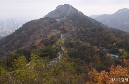
View original imageThe research team witnessed frequent rockfalls from the steep cliffs of Mount Nilkanth, occurring at intervals of 30 seconds to one minute. They also observed glacial retreat, indiscriminate infrastructure development near the Badrinath pilgrimage site, and plastic waste littered around high-altitude glacial lakes. Regarding these findings, the researchers stated, "All these signs, beyond rapid glacier melting, vividly show that the very topography of the Himalayas is being fundamentally shaken by human pressures and climate change." They further warned, "Through this expedition, we found that rockfalls, slope instability, and the uneven thinning of glaciers covered with rock debris are rapidly emerging as urgent and dangerous climate disasters in the high Himalayas."
The authors explained that as temperatures rise, permafrost is thawing, weakening the natural "ice glue" that once bound rocks together, resulting in large-scale rockfalls and landslides that occur one after another. They emphasized, "As mountain environments continue to change, understanding these interlinked disaster processes is key to improving risk assessments and protecting vulnerable Himalayan communities." The authors stressed the urgent need to go beyond the conventional methods of simply measuring the area of glacial retreat, and instead, establish detailed monitoring and risk assessment systems for the chain reactions of rockfalls, landslides, and glacial lake outburst events that threaten the region's stability.
Hot Picks Today
 "There's a Drink Like This?"... Chinese Beverage With "Korean" in Its Name Rakes in 85 Million Won in Monthly Sales
- "Samsung Electronics at 70,000 won, SK hynix at 200,000 won"... Why the gloomy outlook despite 'record-breaking earnings'?
- Woman Found Collapsed Barefoot on Street, Leaving 3-Year-Old Child Unattended... Turns Out She's Part of a "Wealthy Royal Family"
- "I Put in 10 Million Won, but Only 2 Million Won Is Left" ... 77% Plunge Leaves Retail Investors in Samsung Electronics and SK hynix Leveraged ETFs Crying Out
- "The leggings are all see-through. It's so embarrassing to look at," complaints prompt Lululemon to fire development staff.
Coincidentally, just over a month after this article was published, a major flood struck Nepal. Although the Satopanth Glacier and Mount Nilkanth are located in a different region from the Nepal-China border area where the recent floods occurred, the issues of unstable high-altitude bedrock and slope instability are common to both regions. Based on satellite imagery and other evidence, experts estimate that the cause of this flood was the detachment of the lower section of a glacier at about 5,200 meters above sea level, which then tumbled roughly 1,200 meters down to the valley floor. The resulting landslide and debris blocked the river, and when this natural dam suddenly gave way, it likely triggered the catastrophic flood.
© The Asia Business Daily. All rights reserved. Unauthorized AI training and use prohibited.