Soaring Loss Ratios from Extreme Weather... Insurers Look to Space for Solutions
Assessing Climate Disaster Risks More Precisely with Satellite Data
Comprehensive Insights into Insurance Targets and Surrounding Environments
"Limitations Remain for Application in Domestic Underwriting and Loss Adjustment"
As extreme weather and natural disasters increase the loss ratios for crop and windstorm/flood insurance, the insurance industry is focusing on satellite data to improve the accuracy of climate risk analysis. Satellite data can be used to assess exposure to risks such as droughts and floods, and to determine whether insurance payouts are warranted. However, there are concerns in Korea that the infrastructure for analyzing data for direct application in insurance operations is still lacking.

The Falcon 9 launch vehicle of SpaceX carrying the fourth next-generation medium-sized satellite developed through the agriculture and forestry satellite project was launched from Vandenberg Space Force Base in California, USA on the 7th of last month. Photo by Yonhap News Agency
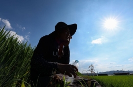
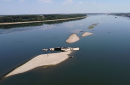
View original imageAccording to the insurance industry on August 9, 2026, the loss ratio for crop disaster insurance increased from about 98% in 2024 to 114% last year. For windstorm and flood insurance, the loss ratio was 36% in 2024, but soared to 236% in the first half of last year.
As the burden of loss ratios due to natural disasters grows, the industry is examining the possibility of adopting satellite data, which can more accurately assess climate risks and supplement the limitations of existing observation data. Satellite data provides a wide range of information not only on direct insurance targets such as buildings and land, but also on surrounding topography, vegetation, and soil conditions.
In particular, it is noted that satellite data can provide information directly related to actual damages from floods, droughts, and property losses, making it useful for insurance payouts. AXA Climate, an affiliate of the global insurer AXA Group, uses satellites to measure soil moisture and identify areas affected by drought, using this as a criterion for payouts in parametric insurance. Parametric insurance is a product in which insurance payouts are made when pre-set conditions such as rainfall or wind speed are met, without investigating the actual amount of damage.
In addition, global reinsurer Swiss Re offers a service that estimates the scale of damage to individual assets by comparing satellite and aerial images taken before and after a natural disaster. This enables insurers to quickly identify losses across wide areas and expedite the process of insurance payouts.
The foundation for utilizing satellite data is also being established in Korea. Last month, the Korea Aerospace Administration, Rural Development Administration, and Korea Forest Service jointly developed and launched the Agroforestry Satellite, which captures images of the entire Korean Peninsula every three days with a resolution of 5 meters and a swath width of 120 km. The Korea Aerospace Research Institute is also developing algorithms that generate information such as atmospheric data, vegetation indices, and soil moisture—data that can be utilized by the private sector—based on satellite images.
However, there are observations that the satellite data currently provided is not sufficient for insurers to acquire all the information required for actual work. Jin-Hyun Han, research fellow at the Insurance Research Institute, stated, "Satellite data that can be directly applied by the insurance industry for risk underwriting and loss adjustment is still limited," and suggested, "The government needs to systematically build up public satellite data and expand infrastructure, such as generating additional information from satellite imagery that can be used by the private sector."
Hot Picks Today
!["Just Holding on Can Be Dangerous"... How to Accelerate Principal Recovery in Samsung Electronics and SK hynix Leveraged ETFs [Weekend Money]](https://cwcontent.asiae.co.kr/asiaresize/93/2026070716323237458_1783409553.png) "Just Holding on Can Be Dangerous"... How to Accelerate Principal Recovery in Samsung Electronics and SK hynix Leveraged ETFs [Weekend Money]
"Just Holding on Can Be Dangerous"... How to Accelerate Principal Recovery in Samsung Electronics and SK hynix Leveraged ETFs [Weekend Money]
- "Bought It as Soon as I Arrived in Korea": Foreigners Flock to Unexpected Spots, Spending Soars 1177% [K-Holic]
- Hong Seokcheon Says "I Get Tested for STDs Every Six Months"... HIV Prevention Pill Available as 'One a Day'
- "President Is Not the Owner, Just a Tenant"... US Court Blocks $400 Million 'Ambitious Project'
- "Shares Plunged 40% From Highs, But Now a Buy Opportunity?"... Securities Firms Reaffirm This Pick [Weekend Money]
He further added, "When using public satellite data, it may be more efficient from the perspective of economies of scale to utilize shared infrastructure such as the Insurance Development Institute, rather than at the individual company level, to secure capabilities in purchasing and analyzing commercial data. If the insurance industry can use satellite data to reduce the costs of risk underwriting and loss adjustment and enhance its risk management capabilities, it can deliver greater societal benefits."
© The Asia Business Daily. All rights reserved. Unauthorized AI training and use prohibited.