Gyeonggi Province Completes Drone-Based 3D Cadastral Resurvey, Establishes Spatial Data for Over 16,000 Parcels
Gyeonggi Province completed its drone-based 3D cadastral resurvey project by the end of May 2026. As a result, spatial information for approximately 16,000 land parcels across 74 districts within the province has been established.
The cadastral resurvey project is a national initiative that converts paper-based cadastral maps, originally created over 100 years ago during the Japanese colonial period, into digital cadastral data. The project aims to protect residents’ property rights by resolving boundary disputes between neighbors and securing road access for landlocked plots, thereby maximizing the value of land use.
With only traditional 2D drawings, it was impossible to fully grasp complex on-site conditions, such as changes in terrain elevation or the three-dimensional shapes of buildings. As a result, survey personnel needed to visit the sites multiple times and conduct additional measurements.

Gyeonggi Province is conducting cadastral surveying using drones. Provided by Gyeonggi Province
View original imageTo streamline field surveys and measurement work, and to enhance residents’ understanding, Gyeonggi Province has fully adopted a method to obtain 3D imagery using drones. Using high-precision orthophotos and videos captured by drones, the topography and buildings were recreated in a lifelike, three-dimensional manner. The established 3D imagery will serve as the core verification material for all administrative procedures, including initial site assessments, boundary consultations, and performance inspections in future cadastral resurvey projects, thereby improving both reliability and efficiency. Additionally, to enhance data sharing and management efficiency among administrative agencies, the province plans to upload the imagery to the Gyeonggi Real Estate Portal, and, after thorough security review, provide the services separately for public and administrative use.
Son Imseong, Director General for Urban Housing at Gyeonggi Province, stated, "The high-precision 3D spatial information secured through this project will serve as a key foundation supporting the main administrative procedures of the cadastral resurvey project," adding, "We will continue to expand the provision of imagery through the Gyeonggi Real Estate Portal and upgrade our technological infrastructure to deliver future-oriented land administration services."
Hot Picks Today
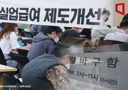 "Let's Give Unemployment Benefits to Those Who Find Jobs Quickly and Stay Long-Term"... Petition Takes Aim at Compensation for 'Voluntary Resignations'
- " 'We're Selling at Half Price' " SH's Ambitious Sale Draws Applications for Just 2 Lots... Risk of Falling Into the Red for the First Time in 14 Years
- After 'Taxing the Rich,' UK Loses KRW 212 Trillion... A Look at Global Cases
- He Heard a "Splash" During a "Sashimi Mukbang" and Threw a Lifebuoy... "Ulzzang Generation" Star Park Jiho Rescues Bystander
- "Shares Hit Daily Limit on 56 Billion Won News"... Marubeni Launches Tender Offer for K-Beauty Firm of 'Chae Sira's Husband' Kim Taewook
Meanwhile, as of now, Gyeonggi Province has launched cadastral resurvey projects in a total of 861 districts (covering 215,534 parcels, 163 square kilometers), completing work in 718 districts. Building on the success of the latest 3D spatial information, the province plans to swiftly proceed with the remaining 138 districts, including those scheduled for 2026.
© The Asia Business Daily. All rights reserved. Unauthorized AI training and use prohibited.