Ministry of Science and ICT - Ministry of Land, Infrastructure and Transport, MOU on Utilization of Restricted Public Space Data
3D Data Such as Aerial Photos, Satellite Images, and Electronic Maps
Previously Usable Only in Gangnam-gu Ministry of Land Security Zones
Now Also Provided in Daejeon, a Data Safe Zone by the Ministry of Science and ICT
The Ministry of Science and ICT (hereinafter referred to as MSIT) and the Ministry of Land, Infrastructure and Transport announced on the 11th that they will sign a data joint utilization business agreement (MOU) to promote the use of restricted public spatial information through data safe zones.

Data safe zones are a system that supports the safe analysis and utilization of unopened data in accordance with the "Framework Act on the Promotion of Data Industry and Utilization." They allow the use of enhanced security data designated by MSIT and related central administrative agencies.
The Ministry of Land, Infrastructure and Transport has designated and operated the Korea Land and Geospatial Informatix Corporation Seoul Headquarters (Gangnam-gu) as a spatial information safe zone since October last year, enabling analysis and utilization of restricted public spatial information that was difficult for general companies or research institutions to access within a secure area. Restricted public spatial information includes high-precision, high-resolution three-dimensional coordinates such as aerial photographs, satellite images, and electronic maps.
Through this agreement, the Ministry of Land, Infrastructure and Transport will provide data to the Daejeon Data Safe Zone (located at Chungnam National University), designated and operated by MSIT, so that companies and research institutions outside the metropolitan area can also use restricted public spatial information.
MSIT plans to provide unopened data such as card data and income and consumption credit statistical information, which are currently provided at the Daejeon Data Safe Zone, to the spatial information safe zone.
Not only the two administrative agencies but also the Korea Land and Geospatial Informatix Corporation and the Korea Data Agency attended the business agreement ceremony and agreed to cooperate.
Hot Picks Today
 "Two Spend 500,000 Won in a Flash, Yet Wait Two Hours?" ... 'Dreamland' Shunned by Kids and Foreign Tourists
- The Era of Getting 200 Million Won After 30 Years Is Over... A Japanese Bank's "Perpetual Department Head" Who Just Clocked In Cries Out
- Spain Hit by Its Worst Tragedy... Lee Kangin, Moreno and Real Madrid Join Soccer World in Mourning
- They Said, “Make It Your Home for Life” - Then Suddenly Kicked 200 Passengers Off... What Happened to the Around-the-World Cruise?
- "130 Rice Bowls Sold Out in a Day"... 'Unfiltered Face' Adds 8 Million Won to Night Market Sales: China's Bungeunwoo
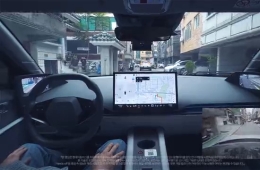
Song Sang-hoon, Director of the Information and Communications Policy Office at MSIT, and Lee Sang-joo, Director of the Land and Urban Office at the Ministry of Land, Infrastructure and Transport, stated, "Spatial information has various potential applications in diverse industrial fields such as autonomous driving and mobility industries, smart agriculture, environment, and energy," adding, "We will continuously cooperate to actively develop new industry sector services utilizing unopened data such as card information from MSIT’s safe zones and restricted public spatial information from the Ministry of Land, Infrastructure and Transport."
© The Asia Business Daily. All rights reserved. Unauthorized AI training and use prohibited.